GOLDEN-NEDERLAND Loop
|
NORTHWEST DENVER FOOTHILLS
1¾ hours round-trip GPS Points:
Black Hawk and Central City are casino towns. We recommend Z Casino in Black Hawk, and Century and Easy Street Casinos in Central City. For lunch we recommend Stella's Cafe in the Famous Bonanza Casino in Central City, and for dinner, Seasons Buffet in the Lodge Casino, Black Hawk. In Nederland we recommend an outdoor table at Busey Brews for a scenic lunch. New Moon Bakery is a nice place to stop for a tasty treat. The Rustic Moose Gift Shop sells Colorado souvenirs and good local toffee. |


|
Rustic Moose Gift Shop in Nederland
|
New Moon Bakery in Nederland
|
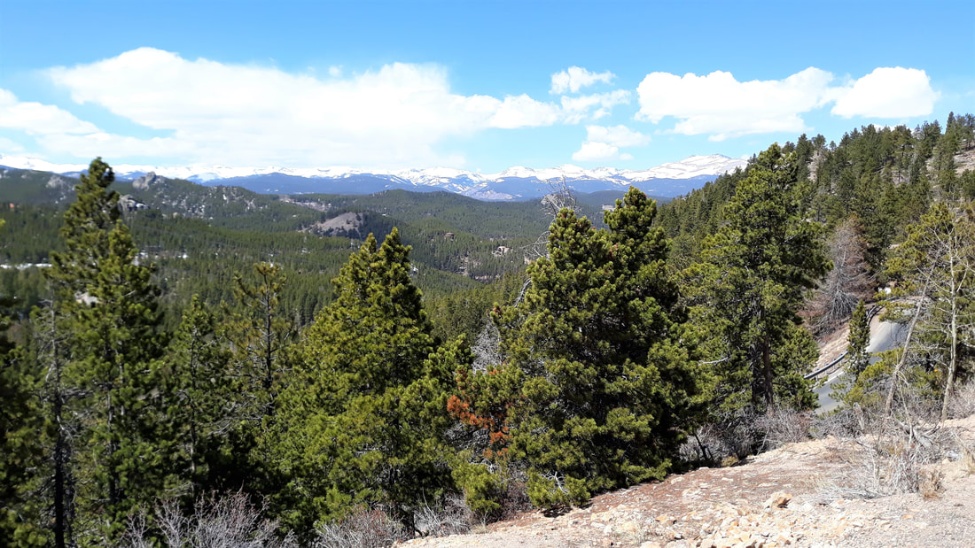
View from CO-72 in Coal Creek Canyon
|
MORRISON-ECHO LAKE Loop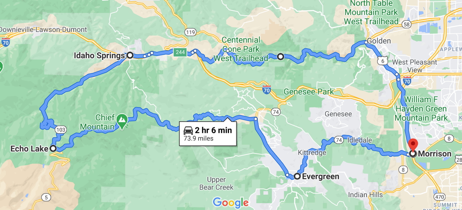
|
WEST DENVER FOOTHILLS
2 hours round-trip GPS Points:
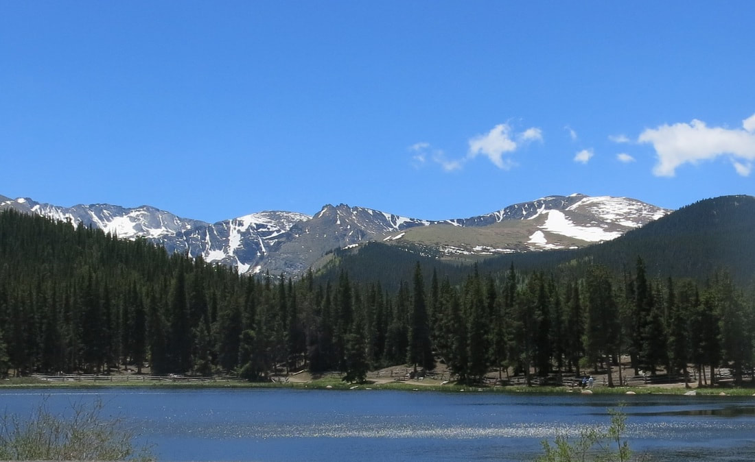
Between Morrison and Evergreen a good, easy hike is Lair O' the Bear Park. Half-shaded and near a stream. 1 mile walk to Dunafon Castle. Recommended in Evergreen: Beau Jo's Pizza, Saigon Landing Vietnamese Restaurant, Little Bear Saloon, Creekside Cellars, Lariat Lodge Brewing, Seasonally Yours Fudge, Evergreen Crafters Gift Shop. Just past Evergreen is Evergreen Lake (watersport rentals; not good for walking in hot weather). Echo Lake Lodge is a seasonal gift shop/restaurant near an easy trail that goes around the lake. In Idaho Springs, we recommend Big B's Soup & Grilled Cheese and Smokin' Yards BBQ. We also like Beau Jo's Pizza and Tommyknocker Brewery, but they charge extra to park. Head east on I-70 west for a few miles and take exit 244. Stay on Hwy 6 through Clear Creek Canyon to Golden. Turn south on 6th Avenue and follow to C-470, back to Morrison. |
|
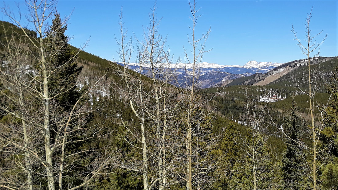
Squaw Pass Road
|
Echo Lake
|
Clear Creek Canyon
|
MORRISON-CONIFER Loop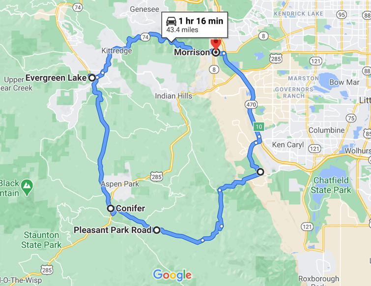
|
SOUTHWEST DENVER FOOTHILLS
1¼ hours round-trip GPS Points:
South Valley Park is a nice place to hike through a red rock landscape. The road to Pleasant Park Road goes through a canyon. Evergreen Lake has watersport rentals but the park offers little shade, so it's not good for walking in hot weather. Recommended in the town of Evergreen: Beau Jo's Pizza, Saigon Landing Vietnamese Restaurant, Little Bear Saloon, Creekside Cellars, Lariat Lodge Brewing, Seasonally Yours Fudge, Evergreen Crafters Gift Shop. A good, easy hike between Evergreen and Morrison is Lair O' the Bear Park. Half-shaded and near a stream. 1 mile walk to Dunafon Castle. |
|
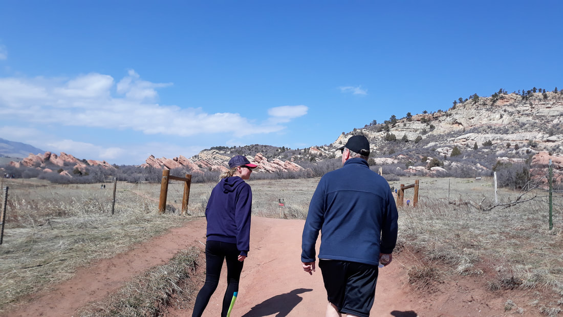
South Valley Park hike
|
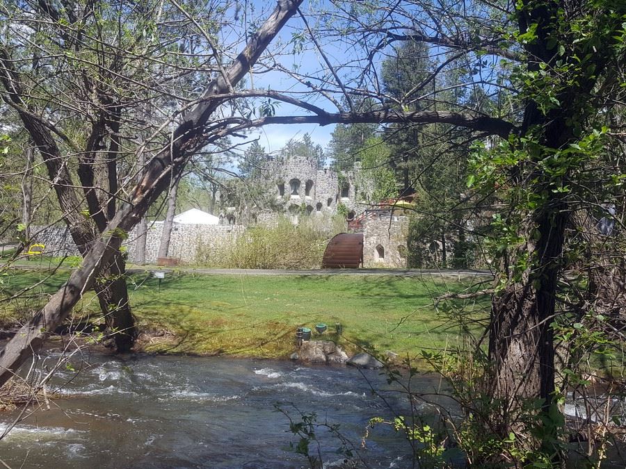
Dunafon Castle,
Lair O' the Bear hike |
CANYON-VALLEY-WINE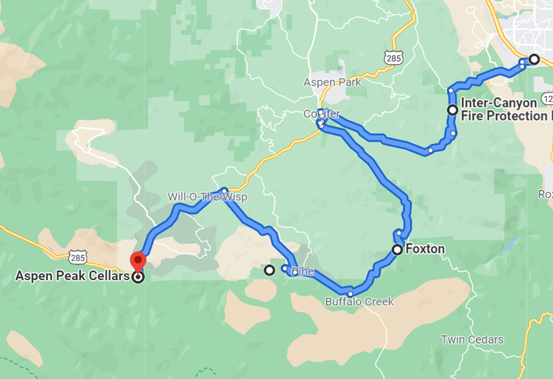
|
SOUTHWEST DENVER FOOTHILLS
2¼ hours round-trip (without stops) GPS Points:
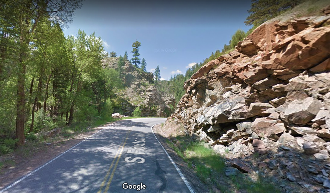
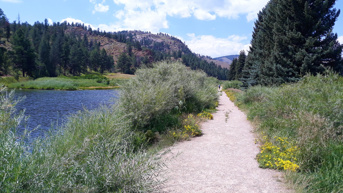
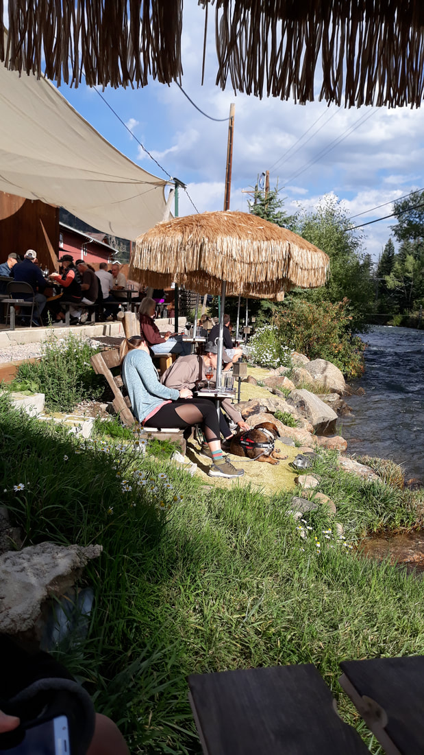
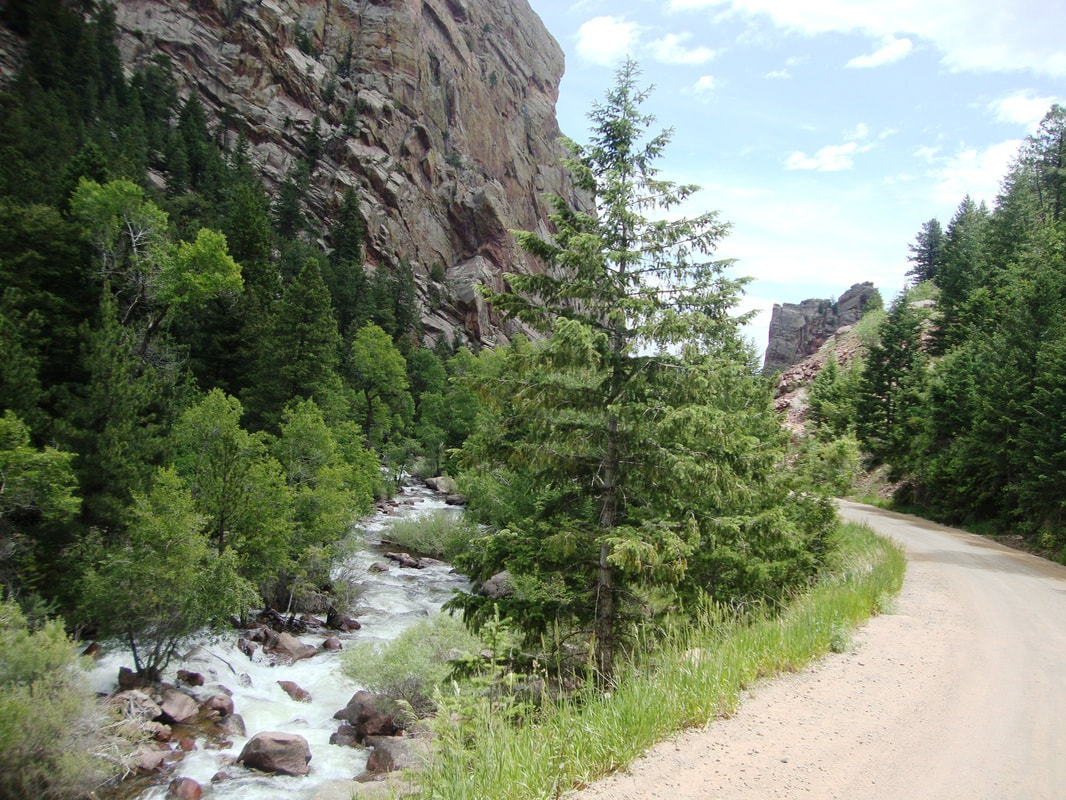
Drive above a steep canyon, between rocky hills, and along a river. A recommended stop along the way is Pine Valley Ranch Park which offers an easy hike. It's less than a mile from the parking lot, around the lake, and back to the lot. Free parking and outdoor restroom facilities. End your journey with a flight of wine and appetizers while sitting by the river at Aspen Peak Cellars. |
|
S Foxton Rd
|
Pine Valley Ranch Trail
|
Aspen Peak Cellars
|
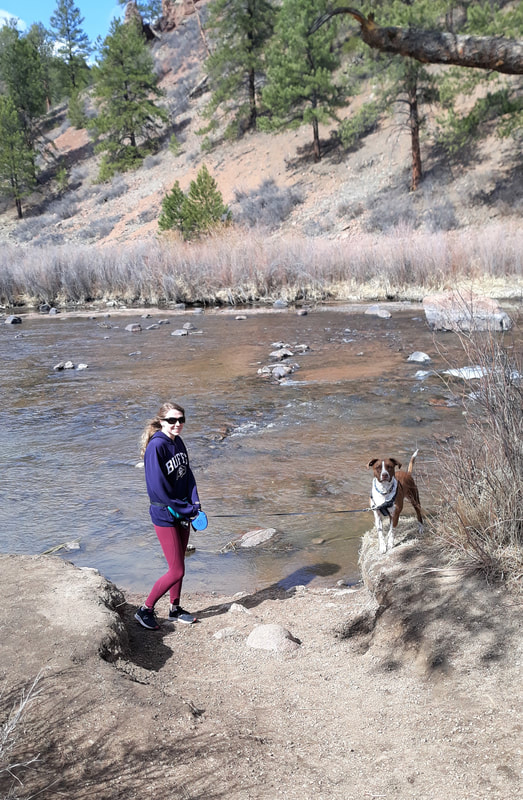
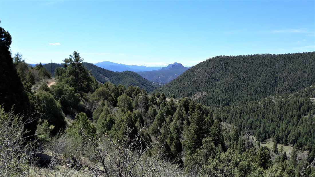
Sedalia-CONIFER Loop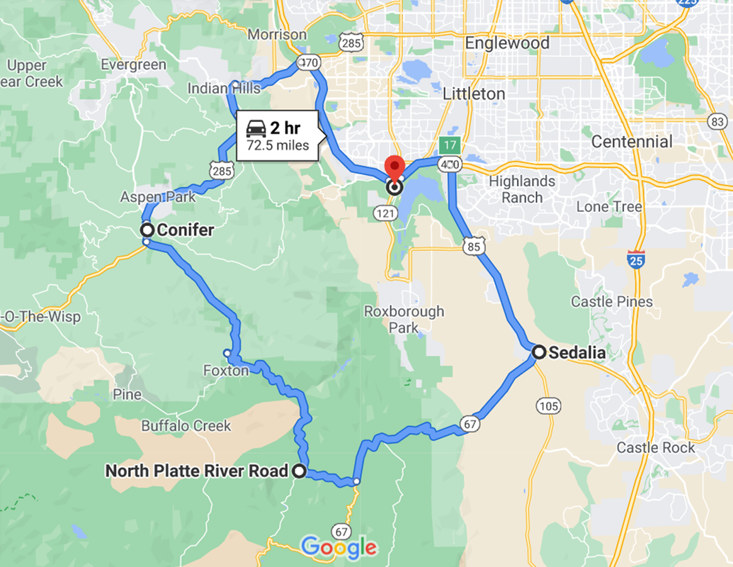
|
SOUTHWEST DENVER FOOTHILLS
2 hours round-trip (recommended late Spring to early Fall) GPS Points:
There are many scenic, dirt parking areas along the rocky South Platte river which runs along N Platte River Road. Good hiking at Reynolds Park between Foxton and Conifer. Dogs allowed. The upper Hummingbird Trail is moderate and less traveled with nice views, some trees and cacti. The Songbird Trail is easy, with a stream and trees. |
|
S Platte River
|
N Platte River Road
|
Views from upper trail at Reynolds Park
|
LOW-ELEVATION STRETCH(Below 8,000 feet)
|
THE FRONT RANGE
Points of Interest, north to south (w/ elevations)
|

|
Eldorado Canyon
|
Roxborough
|
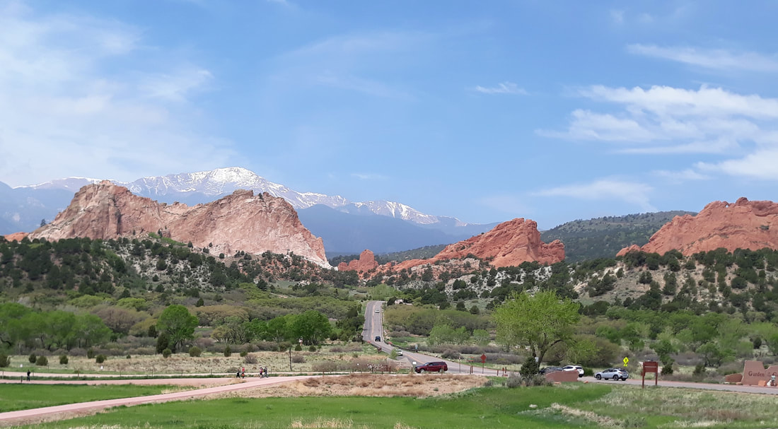
Garden of the Gods
|
KEYSTONE-INDEPENDENCE PASS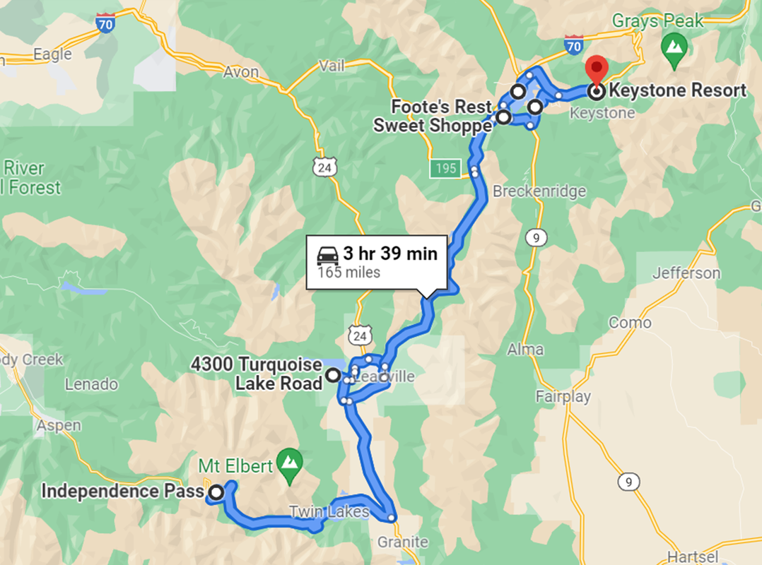
|
CENTRAL ROCKY MOUNTAINS
3¾ hours round trip GPS Points:
From Keystone, take Swan Mountain Road to the Sapphire Point Overlook for a short hike to sweeping views of Dillon Reservoir. Continue on through the historic town of Leadville to an optional loop road that goes around Turquoise Lake. (There is a daily parking fee.) Drive on to Twin Lakes, and then west 18 miles to the summit of Independence Pass. If the pass is closed (winter), drive as far as the road is open. You can turn around there. We've seen mountain goats in the middle of the street during the off-season, and it's a beautiful drive. Heading back, stop at Foote's Rest Sweet Shoppe in Frisco for Colorado's best fudge (in our opinion). Be sure to take Dillon Dam Road back to Keystone for a scenic drive along the reservoir. |
|
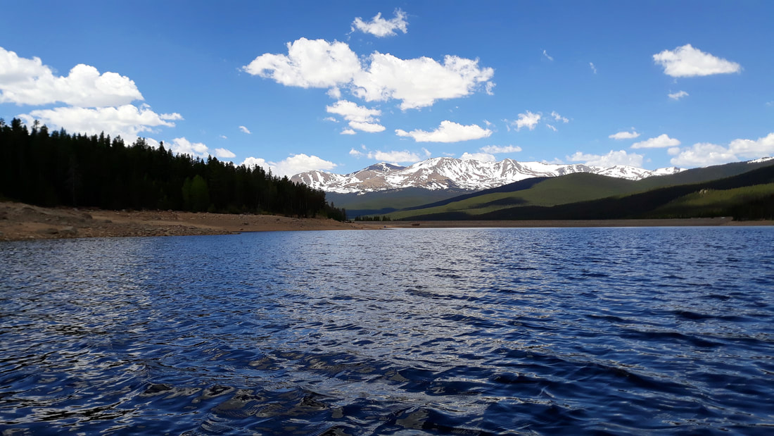
Turquoise Lake
|
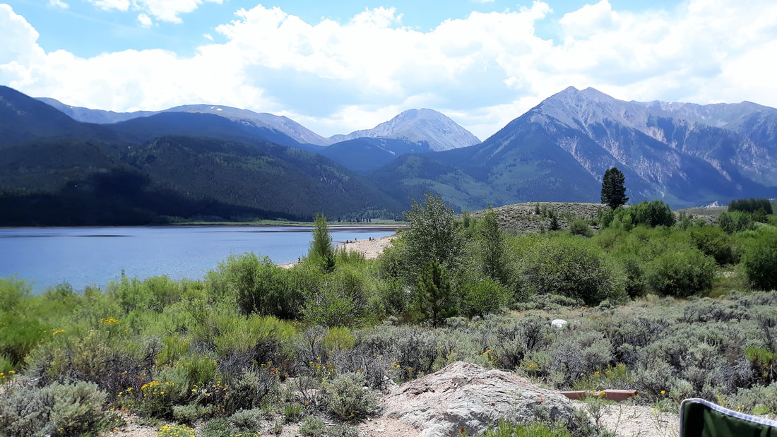
Twin Lakes
|
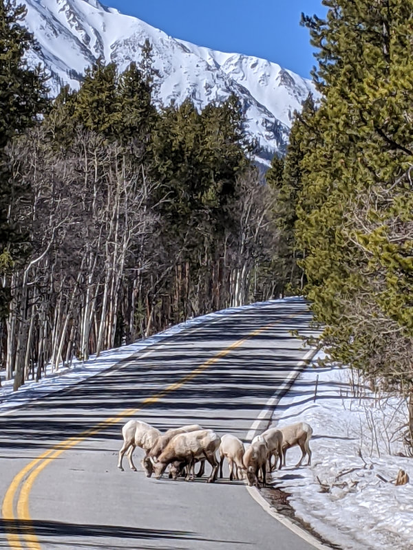
Mountain goats in road to Independence Pass
|